Work involving maps for print, screen, and web including infographics, web-map applications, research tools, retail map products, brochures, flyers, signs, videos, permitting and regulatory documents
Analytical projects involving market research, demographics, site-selection/suitability, lead generation, hydrology/FEMA, academia, heatmaps/interpolation, and data generation
Artistic pursuits mostly involving wood carving and wood burning including 3D carved relief maps and cityscapes of renowned places on the Earth and on other planets within our solar system
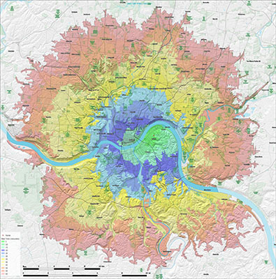
Travel-time choropleth map
Colorburst bicycle travel time map for a residential address in a US city. This was designed as a poster map, so at a quick glance one could plan a quick outing on a bike
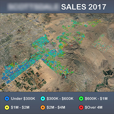
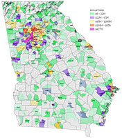
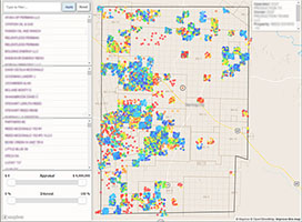
Real estate market analytics
Data aqcuisition and analysis targeting comparable homes for investment opportunities
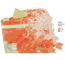
Housing crisis analyses and solutions
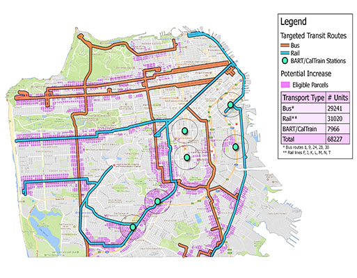
Assessing the potency of proposed regulatory changes along public transportation routes. The analysis targeted certain types of housing units within a given proximity to transportation infrastructure
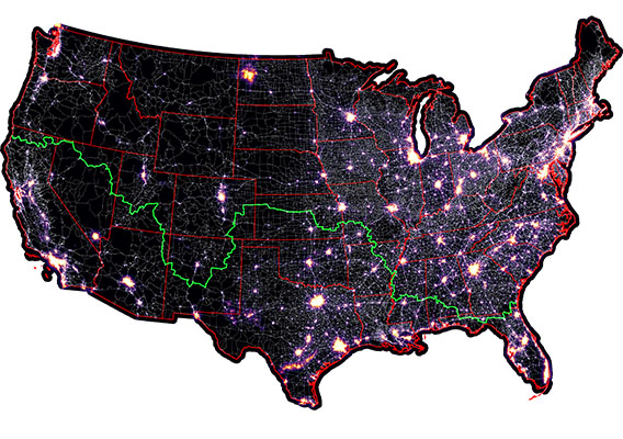
Route optimization (darkest drive)
A cost accumulation network was developed incorporating light pollution data to determine the darkest possible route transiting the US coast-to-coast
Cost-benefit in bulk freight shipping
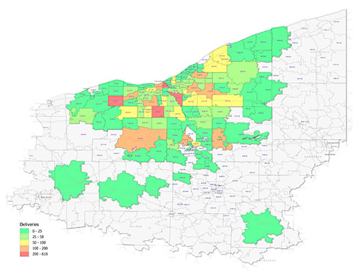
Refining distribution region using a cost-benefit analysis on sales quantity and shipping costs by zipcode
Insolation modeling (sunlight map)
The amount of annual incoming direct and indirect sunlight was computed for a dense metropolitan area. The model was then used to select ideal buildings for rooftop agriculture ignoring those with excessive shade from nearby buildings
Suitability analysis for business venture
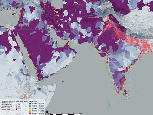
Global shipping ports were assessed thru a complex scoring system gauging target market demographics, climatological demand factors, population density, and proximity to nearby ports. The data and results were made available via a custom web map application
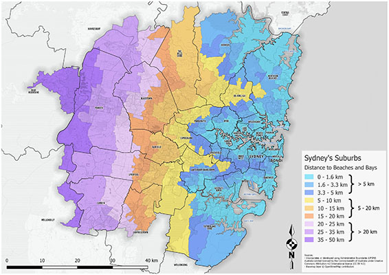
Distance to coast choropleth map
Determining the average geodesic distance from suburbs to coastal waters
New store site selection analysis
Site selection using key demographic data and accessibility/drive-time proximity metrics
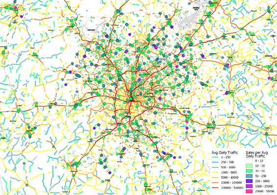
Correlating vehicle traffic and sales
Daily vehicle count data analyzed against restaurant sales totals identified hot-spots and corridors of high exposure, high performing real estate
Restaurant sales performance
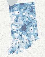
Demographics analysis
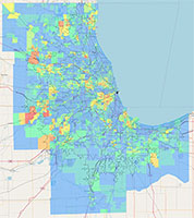
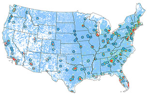
Market research webmap
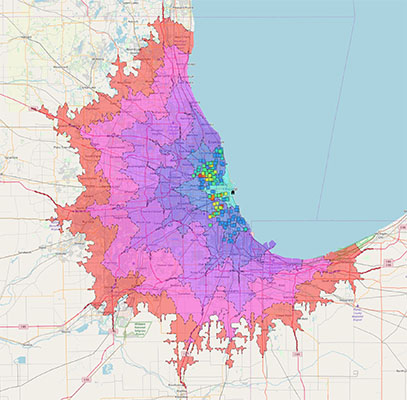
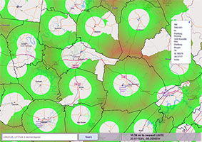
Population served analysis
Proximity analysis webmap
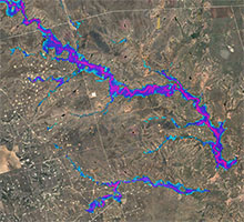
FEMA/base flood elevation modeling
Housing & development analytics
Demographic research
Lets Talk
Whether you have need of a map designer, spatial analyst, GIS technician or are looking for an imaginative person to create entirely unique cartographic and woodburned art, please feel free to reach out and chat with me about your project.